Hi-Cloud, a leader of 3D laser scanning technology.
 |
| Place of Origin: | China |
| Brand Name: | Hi-Cloud |
| Certification: | ISO, others upon the requests |
| Model Number: | ARS-200 UAV Mapping System |
| Minimum Order Quantity: | 1 |
|---|---|
| Price: | Negotiable |
| Packaging Details: | Transport Case |
| Delivery Time: | 20-30 working days |
| Payment Terms: | T/T |
| Supply Ability: | 10 sets/month |
| Measurement Range: | 3 To 330 Meters | FoV: | 60°~90° |
|---|---|---|---|
| Range Accuracy: | 15mm @150m | Repetition Accuracy: | 10mm @150m |
| Operation Temperature: | -10℃~+40℃ | Multi Echo: | 5 Times |
| Highlight: | LiDAR UAV Mapping System,15mm UAV Mapping System,15mm lidar mapping system |
||
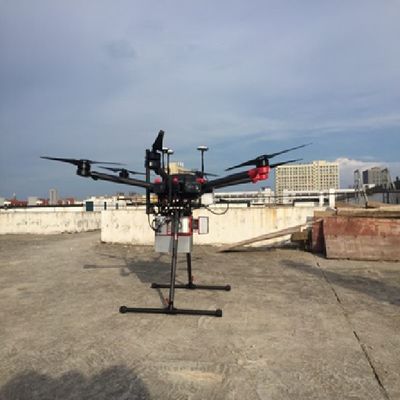
Multi platform mapping system ARS-200 LiDAR with the high accuracy of 15mm and the high frequency of 100000 points/s
ARS-200 mapping system is an airborne LiDAR which can be mounted on multi platforms, such as multi rotor UAV, vehicle and backpack. It is a Riegl LiDAR based system which developed and built by Hi-Cloud. The whole integrated system is consisted of different sensors such as high-precision laser, high-definition camera, GPS, MEMS inertial navigation and storage control unit. With the time synchronization technology of Hi-Cloud, the ARS-200 system synchronously obtains 3D laser point cloud, POS data and image data.
Main Features of the system:
i. It supports a variety of carrier platforms. According to different industry directions and application scenarios, it can be used with UAV, automobile and backpack.
ii. Each platform is equipped with corresponding rapid installation structure design, which can realize screw free rapid installation, greatly reduce the installation and deployment time on site, and a single person can quickly install without any tools.
iii. The waterproof and dustproof grade of the system is better than IP64. Under normal working environment, there is no dust entry and moisture condensation in the body, and the equipment can operate normally.
iv. The equipment is light and compact, with a weight of only 2.5kg. The lightweight equipment.
Based on the features and advantages, the ARS-200 UAV mapping system can be widely used in emergency mapping, topographic mapping, power line inspection, highway survey, coastal reef survey, excavation and filling calculation, archaeological survey and mapping and other fields.
ARS-200 UAV mapping system specifications
| Items | Indicator | Parameter |
|
System Performance |
Absolute Accuracy |
horizontal <5cm vertical <5cm |
| Weight | 2.5kg | |
| Storage | 256GB SSD | |
| Operation Temperature |
-10℃~+40℃ |
|
| Storage Environment | -20℃~+50℃ Humidity < 85% |
|
| Laser Class | Class1(eye safe) | |
| Laser Scanner | Maximum Measurement Range | 330m @80% 290m @60% |
| Minimum Measurement Range | 3m | |
| Range Accuracy | 15mm @150m | |
| Repetition Accuracy | 10mm @150m | |
| Max. Effective Point Frequency | 100000 points/s | |
| Maximum number of received echoes | 5 | |
| FoV(selectable) | 0~360° 60°~90°airborne mode |
|
| Scan Frequency(selectable) | 10~100 scans/s | |
| Angular Resolution | 0.001° | |
| POS System | Position Accuracy(post-processing) | Horizontal 0.01m Elevation 0.02m |
| Orientation Accuracy(post-processing) | Heading 0.012° Pitch/Roll 0.005° |
|
| Camera System | Camera Resolution | ≥24MP |
| Camera Weight | <500g |
The main line of the project is about 8km long. The survey area is mainly mountainous terrain, with an average altitude of 600m. The river crosses the survey area, and the altitude drop in some areas is large. The vegetation in the survey area is lush, mostly evergreen broad-leaved forest and low shrubs.
The main task of the project is airborne LiDAR survey and point cloud processing of the certain section of the highway. The mean square error of point cloud elevation is required to be less than 15 cm.
The traditional surveying and mapping operation is more dangerous because of the traffic on the highway. It is difficult for GNSS receiver to receive satellite signals due to dense vegetation and large altitude drop in the survey area.
ARS-200 UAV mapping system is applied in this project. After trajectory calculation, point cloud combine and other data processing processes, the point cloud result is as follow:
![]()
Contact Person: Mr. EPiC Team
Tel: +8618520517897