Hi-Cloud, a leader of 3D laser scanning technology.
 |
| Place of Origin: | China |
| Brand Name: | Hi-Cloud |
| Certification: | ISO, others upon the requests |
| Model Number: | PM-1500 UAV LiDAR System |
| Minimum Order Quantity: | 1 |
|---|---|
| Price: | Negotiable |
| Packaging Details: | Transport Case |
| Delivery Time: | 20-30 working days |
| Payment Terms: | T/T |
| Supply Ability: | 15 sets/month |
| Range: | 1500m@60% Reflectivity | Range Accuracy: | 5mm@50m |
|---|---|---|---|
| FoV: | 75° | Scan Speed: | 40-400 Scans/s |
| Wave Band: | Near Infrared (Class 1 ) | PRR: | 100-2000Khz |
| Camera Resolution: | 42.4MP | Multi Echo: | 4 Times |
| Highlight: | High Frequency UAV LiDAR System,100Khz UAV LiDAR System,100Khz lightweight lidar |
||
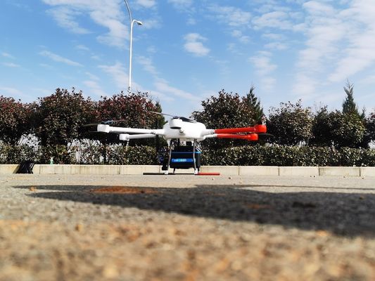
High freuency 2million points/s high accuracy 5mm@50m lightweight 4.4kg UAV LiDAR System PM-1500 with range 1500m
PM-1500 UAV LiDAR system, based on a new generation of core technology framework, is a newly launched domestic airborne LiDAR with high point frequency, high line frequency, high precision and high integration. The core component of laser scanner with multi echo technology is independently developed by Wuhan Hi-Cloud Technology Co.,Ltd. The whole system integrates modules such as high-precision inertial navigation module and aerial survey camera. With the innovatively optimized structure, the weight of PM-1500 UAV LiDAR system is only 4.4kg. PM-1500 can be mounted on different carriers, like multi rotor UAV, VTOL fixed wing UAV, small aircraft and helocopter.
Supported by the time synchronization technology of independent intellectual property rights and integrated multi-sensor integration technology, it can synchronously obtain 3D laser point cloud and POS data, quickly generate DSM, DEM and DOM and produce DLG and 3D models through a complete set of data processing and application software.
It is widely applied in different fields as basic surveying and mapping, digital 3D modeling,topographic surveying and mapping, cadastral survey, traffic survey, power line inspection, forestry survey, disaster monitoring and so on.
Specification of PM-1500
| Indicators | Parameters | Indicators | Parameters |
| Wave Band | Near Infrared (Class 1 ) | Focal Length | 28mm |
| PRR | 100-2000Khz | Position Accuracy(post-processing) |
Horizontal 0.01m Elevation 0.02m |
| Maximum Measurement Range | 1000m@20% reflectivity | Orientation Accuracy(post-processing |
Heading 0.009° Pitch/Roll 0.005° |
| 1500m@60% reflectivity | Dimension | 293×165×164mm | |
| Range Accuracy | 5mm@50m | Absolute Accuracy |
horizontal <5cm vertical <5cm |
| Angular Resolution | 0.001° | Weight | 4.4kg |
| Scan Speed | 40-400 scans/s | Multi Echo | 4 times |
| FoV | 75° | Temperature and Humidity | Operation: -40℃~60℃, Humidity 85% |
| Camera Resolution | 42.4MP | Storage: -45℃~70℃, Humidity 85% |
Features of PM-1500
Application projects of PM-1500
1. 3D city model project: obtain the building height through the 3D model, obtain the building information through the oblique image and ground photos, and then build the building information database.
![]()
![]()
![]()
![]()
2. Topographic mapping project:
![]()
![]()
![]()
3. Inspection of 500kV DC transmission line project: the inspected line of the project is 500kV DC transmission line segment, including 3 base towers and 2 intervals, with a total length of about 0.8km.
![]()
![]()
Contact Person: Mr. EPiC Team
Tel: +8618520517897