Hi-Cloud, a leader of 3D laser scanning technology.
 |
| Place of Origin: | China |
| Brand Name: | Hi-Cloud |
| Certification: | ISO, others upon the requests |
| Model Number: | ARS-1000L lightweight UAV LiDAR System |
| Minimum Order Quantity: | 1 |
|---|---|
| Price: | Negotiable |
| Packaging Details: | Transport Case |
| Delivery Time: | 10 working days |
| Payment Terms: | T/T |
| Supply Ability: | 10 sets/month |
| Weight: | 4.5kg | Storage: | 1TB SSD |
|---|---|---|---|
| Operation Temperature: | -10℃~+40℃ | Range: | 5m To 1350m |
| Range Accuracy: | 15mm @150m | Repetition Accuracy: | 10mm @150m |
| Highlight: | 5m LiDAR Terrain Mapping,Lightweight LiDAR Terrain Mapping,lightweight UAV Mapping System |
||
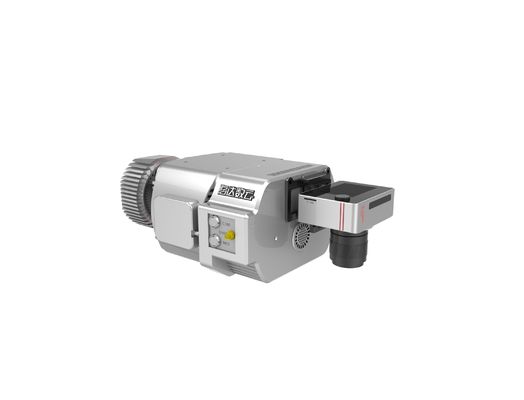
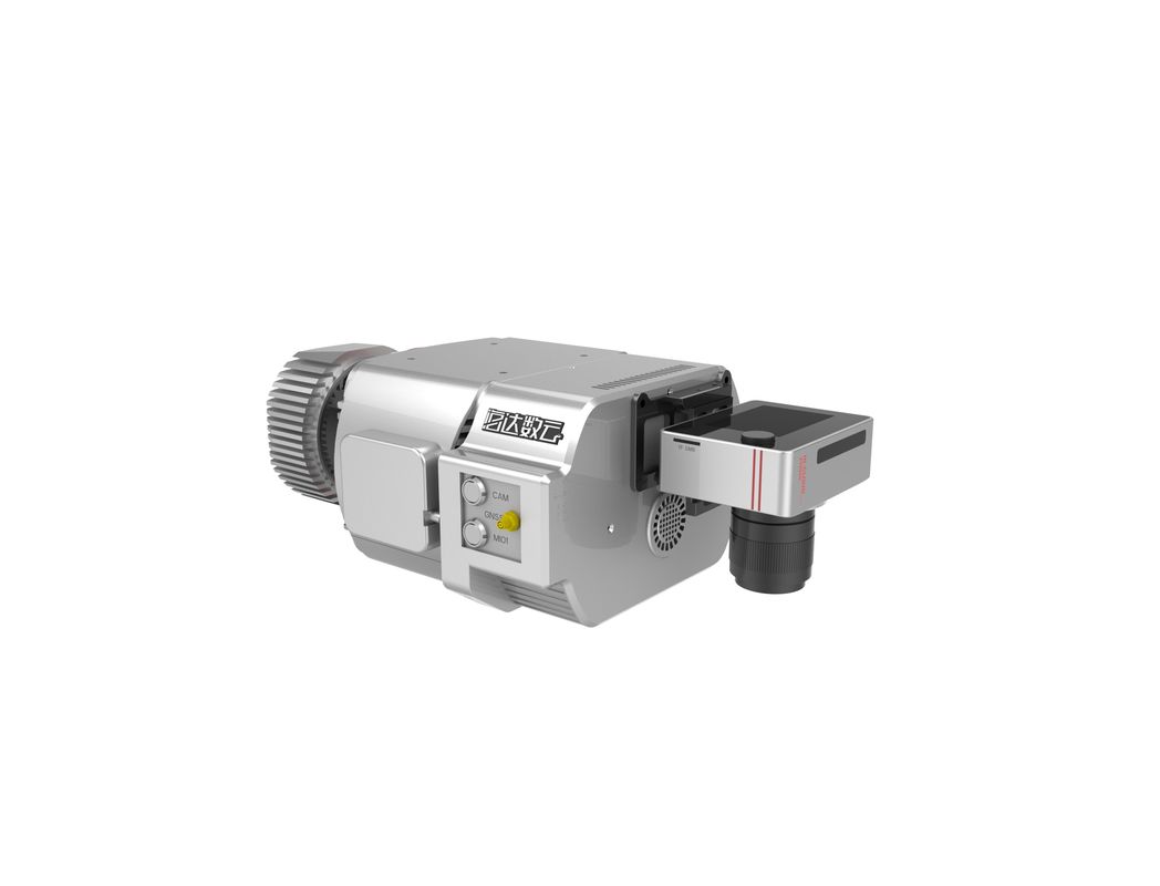
4.5kg lightweight 15mm@150m ARS-1000L UAV LiDAR System multi operation mode and 5m to 1350m range
ARS-1000L UAV LiDAR system is a is a Riegl LiDAR based system which developed and built by Hi-Cloud. It integrates sensors such as high-precision laser, high-definition camera, GPS, MEMS inertial navigation and storage control unit. Supported by time synchronization technology of independent intellectual property and integrated multi-sensor integration technology, it synchronously obtains 3D laser point cloud, POS data and image data. The system has the advantages of light weight, convenient transportation and high efficiency of results processing. It is widely used in emergency mapping, topographic mapping, power line inspection, highway survey, coastal reef survey, excavation and filling calculation, archaeological survey and mapping and other fields.
Specification
ARS-1000L UAV LiDAR System
| Items | Parameters | ||
| System Performance | Absolute Accuracy | ±5cm | |
| Weight | 4.5kg | ||
| Operation Mode | Airborne/Vehicle mounted/Backpack | ||
| Laser Scanning Unit | Laser Classification | Class 1 | |
| Max. Measurement Range | 1350m@60% | ||
| Max. Effective Scan Speed | 750,000points/s | ||
| Data Update Rate | 200Hz | ||
| FoV | 330° | ||
| Angular Resolution | 0.001° | ||
| Multi-echo Function | Available | ||
| INS | Position Accuracy (post-processing) | Horizontal | 0.01m |
| Elevation | 0.02m | ||
| Heading Accuracy | 0.010° | ||
| Pitch/roll Accuracy | 0.005° | ||
System advantages:
Application of Highway Reconstruction and Expansion
![]()
Contact Person: Mr. EPiC Team
Tel: +8618520517897