Tel:
Request A Quote
English
English
French
German
Italian
Russian
Spanish
Portuguese
Dutch
Greek
Japanese
Korean
Arabic
Hindi
Turkish
Indonesian
Vietnamese
Thai
Bengali
Persian
Polish
Wuhan Hi-Cloud Technology Co.,Ltd
Hi-Cloud, a leader of 3D laser scanning technology.
Home
Products
3D Laser Scanners
Terrestrial Laser Scanners
Industrial Laser Scanner
Airborne LiDAR System
Airborne LiDAR Survey
UAV Mapping System
UAV LiDAR System
Mobile LiDAR System
LiDAR Mobile Mapping System
2D Laser Profiler
3D LiDAR SLAM
Multi Rotor UAV
VTOL Fixed Wing UAV
Control System Software
LiDAR Point Cloud Software
Data Preprocessing Software
Logging System
Hydrological Survey Equipment
About Us
Factory Tour
Quality Control
Contact Us
Request A Quote
News
Sorry! This product is no longer available.
Let's see if there are any related products that interest you
Recommended Products
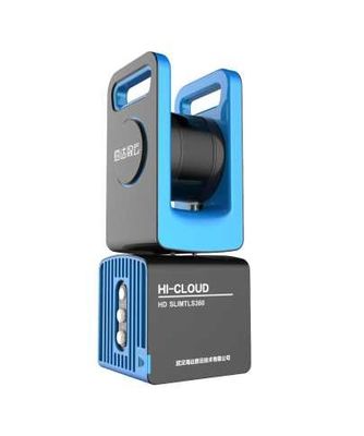
0.2-150m Range HD TLS360 3D Laser Scanners
1~2500ΩM 0~250℃ Geothermal Resistivity & Inclinometry with Platinum Resistance Sensor
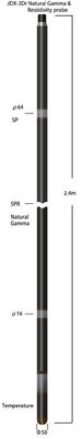
Natural gamma Range 0~65000CPS NaI Crystal+Photomultiplier Geothermal Temperature&Gamma
Temperature 0~75℃ pH range 0~14pH Dissolved-oxygen0~50ppm Water Quality Probe
5μS/M Accuracy Sonic Probe With Ceramic Piezoelectric Transducer
125-555μS/M Sonic Temperture Inclinometer Probe With Pt100 Sensor
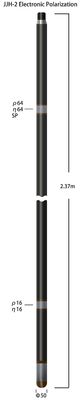
Resistivity 1-4000ΩM Electronic Polarization Probe Accuracy 2% ± 1Ωm
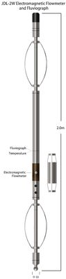
13-1500mm/S Range 0.2mm/S Resolution Electromagnetic Flowmeter And Fluviograph
0-360 Deg Azimuth Range Drilling Probe Fiber Optic Gyroscopes Inclinometer Directional
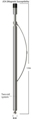
10-10000×10-4 SI Two Coil logging tool Magnetic Susceptibility With 5%F.S Resolution
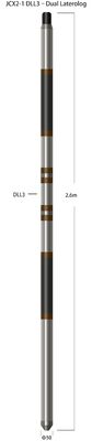
Counter Range 0-10KΩm Accuracy 5% Dual Probe Stainless Steel Laterolog
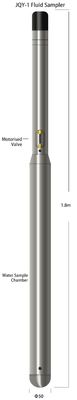
1L Volume Bipolar Codes Signal Fluid Sampler Probe For 75 deg 20MPa Environment
UAV Flow Measurement System Velocity 0.03-20m/S Resolution 1mm/S
Acoustic Inertial Hydrological Survey Equipment Detection Range 0.2~250m
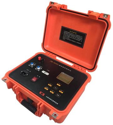
1000 - 1500mm Length Probe Digital Logging System
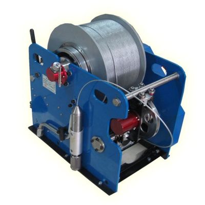
Ambient Temperature - 20 - + 45C IP56 DJ Winch For Logging System
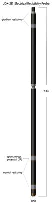
Constant Power Electrical Resistivity Probe For Logging System
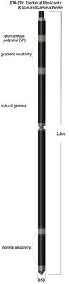
NaI Crystal sensor Electrical Resistivity And Natural Gamma Probe
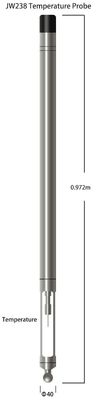
0 - 100 Celsius Degree PT100 Temperature Probe
PT100 Platinum Resistance Electrical Resistivity Natural Gamma Probe
Wuhan Hi-Cloud Technology Co.,Ltd
Mobile Site
Privacy Policy
|
China 0.2m 3D Laser Scanners
Supplier.
Copyright © 2021 - 2025 Wuhan Hi-Cloud Technology Co.,Ltd. All Rights Reserved. Developed by
ECER