Hi-Cloud, a leader of 3D laser scanning technology.
 |
| Place of Origin: | China |
| Brand Name: | Hi-Cloud |
| Certification: | ISO, others upon the requests |
| Model Number: | iAuqa LiDAR mobile mapping system |
| Minimum Order Quantity: | 1 |
|---|---|
| Price: | Negotiable |
| Packaging Details: | Transport Case |
| Delivery Time: | 30 working days |
| Payment Terms: | T/T |
| Supply Ability: | 5 sets/month |
| Application: | Reef Surey | Range(Above Water): | 450m/650m/1200m |
|---|---|---|---|
| Under Water: | Bathymetry | Scan Rate: | Max. 500,000 Pts/sec |
| FoV(Horizontal): | 360° | FoV(Vertical): | 100° |
| Highlight: | 450m LiDAR Mobile Mapping System,Reef Survey LiDAR Mobile Mapping System,1200m mobile lidar survey |
||
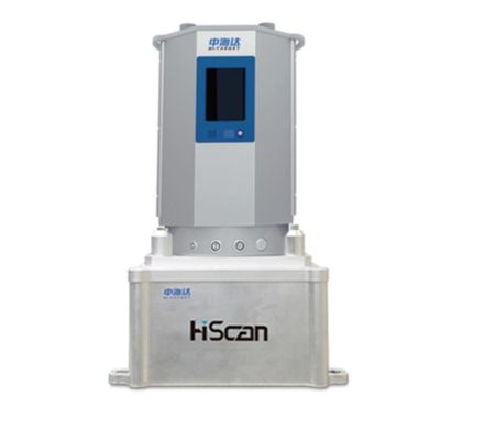
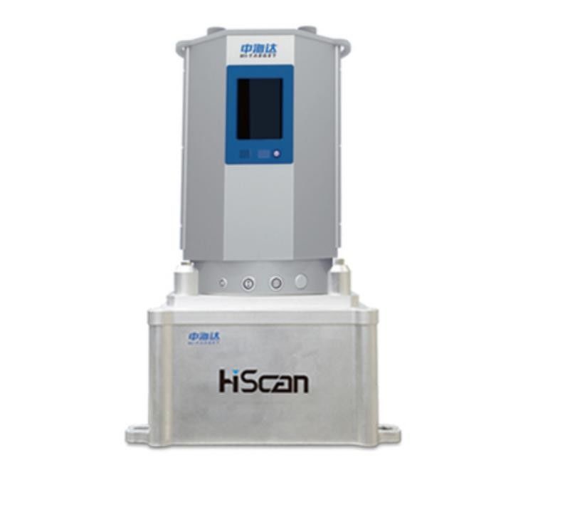
450m/650m/1200m above water range 360°×100° FoV 15cm@100m accuracy iAqua LiDAR mobile mapping system for reef survey
The traditional topographic survey of coastal islands and reefs mainly adopts the survey operation mode of the combination of real-time dynamic differential positioning system (RTK) and total station. However, in steep cliff areas, large areas of beaches, swamps, and islands and reefs in difficult areas, it is difficult to carry out island landing / landing point survey through RTK operation, which is difficult to meet the needs of coastal islands and reefs emergency survey.
Hi-Cloud iAqua shipborne 3D laser mobile measurement system is highly integrated by 3D laser scanner, satellite positioning system, inertial navigation system, panoramic camera, system control module and high-performance board computer. It can quickly obtain high-precision positioning and attitude data, high-density 3D laser point cloud above water, underwater multi beam data and high-definition panoramic images. It can easily complete the production and application of above water and underwater topographic mapping, 3D geographic data and real scene data. It is widely used in water area (river, lake, reservoir area, coastal zone, island reef and channel) mapping, river / port / coastal facilities survey and dynamic monitoring, digital water conservancy, digital navigation, digital ocean and other fields.
Features:
1. Integration: high integration of multiple sensors
2. Calibration-free: high-precision integrated rigid platform
3. High precision: high measurement accuracy
4. High reliability: stable and reliable system
5. Easy to install: no need to modify the carrier
6. Same benchmark: unified benchmark for above water and underwater
Parameters:
| Model | iAqua |
| Number of Scanners | 1 |
| Measurement Range(Above Water) |
450m/650m/1200m(Optional)
|
| Measurement Range(Under Water) | Compatible with various brands and models of bathymetry module /multi-beams |
| Scan Rate |
Max. 500,000 pts/sec |
| Scan FoV | 360°×100°(horizontal×vertical) |
| Panoramic Camera | Ladybug/ HD camera(Optional) |
| Panoramic Resolution | 30M/75M pixels |
| System Accuracy | Above water:15cm@100m |
Contact Person: Mr. EPiC Team
Tel: +8618520517897